Tarawa Shoreline Reality
Tarawa Shoreline RealityPosted by Mason O'Donnell on 10-08-2026
Useful Tips
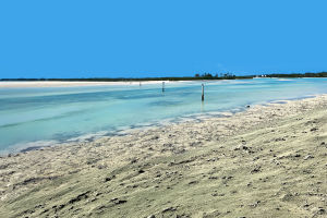
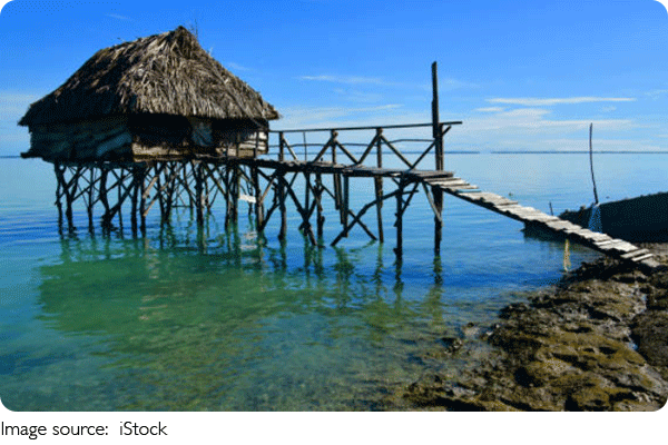
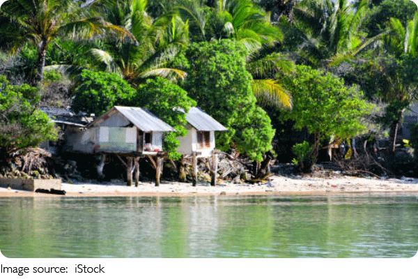
Tarawa is not a conventional tropical beach escape. South Tarawa is a narrow, densely populated part of Kiribati where homes, roads, public infrastructure, lagoons, and the Pacific sit remarkably close together.
Coastal protection is therefore part of everyday life: visitors may encounter seawalls, raised infrastructure, reclaimed sections, and community-scale responses to erosion and flooding.
For Lykkers interested in this subject, two full days and three nights provide enough time. Base yourself in South Tarawa, arrange transport locally, and treat protection structures as infrastructure rather than recreational attractions.
Tarawa
Prepare for Remote Tarawa
Tarawa requires more preparation than many Pacific destinations. Flights are limited, tourism infrastructure is modest, and South Tarawa stretches along a long, narrow chain of connected islets. Confirm accommodation and airport transfer before arrival.
Choose February to October carefully
Kiribati is hot throughout the year, with daytime temperatures commonly around the upper 20s to low 30s Celsius. Rain is possible year-round, while conditions vary considerably between years.
Rather than choosing dates purely by temperature, check rainfall forecasts and tide information shortly before traveling. Coastal conditions can look completely different between high and low tide.
Plan outdoor shoreline visits between approximately 07:30 and 10:30 or after 16:00. Midday heat and limited shade make long walks unnecessarily tiring.
Bring strong sun protection, lightweight rain protection, sturdy sandals or walking shoes, and a reusable water bottle. Drink treated or commercially supplied drinking water rather than assuming every local source is suitable.
Stay around Bairiki or Betio
Bonriki International Airport lies at the eastern end of South Tarawa, while Bairiki and Betio are farther west. The road distance to Bairiki is roughly 20 km and to Betio approximately 30 km.
Do not interpret these distances using normal urban driving speeds. South Tarawa's main road can become congested, so Bonriki to Bairiki may require around 45 to 75 minutes and reaching Betio can take longer.
Accommodation choices are limited compared with major Pacific tourism centres. Simple guesthouses may fall around AUD 60 to 100 per night, while more comfortable rooms can reach approximately AUD 100 to 160 or more. Reserve roughly AUD 210 to 450 for three nights.
Kiribati uses the Australian dollar, simplifying budgeting for visitors carrying AUD cash. Cards should not be your only payment method. Carry smaller notes for transport, food, and minor purchases.
Budget AUD 70 to 120 daily
South Tarawa has buses and taxis, but hiring a driver for several hours is more efficient when your purpose is examining specific coastal areas. Ask your accommodation to arrange one and agree on the total price before departure.
Allow roughly AUD 20 to 50 for local transport during a focused sightseeing day, depending on distance and whether the vehicle waits for you. Public transport can reduce this considerably.
Straightforward meals may cost roughly AUD 10 to 20 per person, while imported ingredients and more visitor-oriented dining increase prices. A useful daily allowance is AUD 30 to 50 for meals and drinks.
Read the Coast Properly
Do not search for one famous seawall and declare the trip complete. Tarawa's shoreline protection makes more sense when you compare several environments and understand why individual structures exist.
Start around Bairiki
Begin around 08:00 with a locally arranged driver or guide and spend roughly 60 to 90 minutes examining accessible shoreline sections around central South Tarawa.
Look for the relationship between the road, buildings, lagoon, ocean, and protective structures. South Tarawa's extremely low elevation is the central issue: much of the atoll sits only a few metres above sea level.
Kiribati has implemented major adaptation work with international partners. The Kiribati Adaptation Program, for example, included coastal protection, water management, and infrastructure measures designed to reduce vulnerability to climate-related hazards.
Do not climb seawalls or enter active construction areas for photographs. These structures protect communities and infrastructure and may contain unstable surfaces.
Compare Betio later in the morning
Continue west toward Betio and allow approximately 45 to 75 minutes for the drive depending on traffic and your starting point.
Spend another 60 to 90 minutes examining publicly accessible coastal areas. A local guide adds considerable value because a concrete structure alone cannot tell you when it was installed, who maintains it, or which flooding problem it addresses.
Photography should remain respectful. Avoid treating damaged shorelines or nearby homes as dramatic scenery. Ask before photographing residents at close range or private property.
Keep roughly AUD 30 to 60 available if arranging several hours of local guiding or private transport, but confirm the actual quotation through your accommodation because there is no dependable universal visitor tariff.
Use the tide as part of the itinerary
Return to one accessible shoreline location at a different tidal stage. Allow 30 to 45 minutes. This can reveal why evaluating coastal protection from a single photograph is misleading.
Do not walk onto exposed reef areas without local advice. Tides can change access conditions, surfaces can be sharp or slippery, and strong sun makes longer exposed walks demanding.
Keep your second full day flexible for another coastal section, lagoon trip, or locally guided community visit. Avoid scheduling a distant excursion immediately before your flight because road delays can make the return unpredictable.
A realistic three-night Tarawa trip requires roughly AUD 350 to 650 per person for accommodation, meals, local transport, and basic sightseeing, excluding international flights. The biggest mistake is expecting an uncomplicated beach holiday.
Tarawa is more valuable for Lykkers who want to understand how an exceptionally low-lying Pacific community lives beside a changing shoreline. Stay three nights, compare several coastal areas, revisit one at a different tide, and use local knowledge to understand what the protection structures actually mean.
Popular
WAFCON Begins Here
Sixteen teams are ready! Who will write the next chapter of WAFCON?
Quarter-Final Race!
Who secured a quarter-final spot? The competition just got even tougher!
Four Acts to Watch!
Four live performances, one unforgettable day! Which artist will steal the show?
Langkawi Paradise
Discover Langkawi Island, Malaysia’s tropical paradise with beautiful beaches, natural wonders, and island adventures.