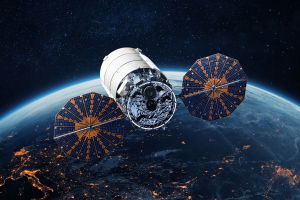
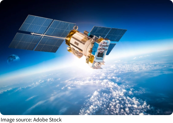
Satellite Eyes on Earth
Satellite Eyes on EarthPosted by Pardeep Singh on 18-03-2026
Funny Facts
Ever noticed how weather apps suddenly warn you about a storm, or how news shows satellite images of melting ice caps?
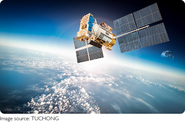
Behind these snapshots lies a vast network of satellites orbiting Earth, quietly gathering critical information.
These technologies don't just give us pretty pictures—they're transforming how we monitor our planet, spot environmental changes early, and respond faster.
Tracking Climate Patterns
Satellites provide a bird's-eye view of the atmosphere, oceans, and land, allowing scientists to observe climate trends over years. They can detect rising global temperatures, shifts in precipitation, and changing wind patterns.
Actionable example: Organizations like NASA and NOAA provide free satellite datasets online. By accessing historical temperature or rainfall data, students or enthusiasts can chart changes over decades, understanding climate trends firsthand.
For instance, satellite sensors measure sea surface temperatures, revealing warming hotspots that could lead to stronger hurricanes. Observing these patterns helps authorities issue more precise warnings and prepare communities in advance.
Monitoring Deforestation and Land Use
Satellites equipped with optical and infrared sensors can detect changes in vegetation, identifying illegal logging, wildfires, or land degradation. Unlike ground surveys, satellites cover vast regions quickly, spotting problems that might otherwise go unnoticed for months.
Actionable example: Apps like Global Forest Watch use satellite data to show live forest loss. Users can explore deforestation trends in specific regions, learning how human activities affect ecosystems and contributing to citizen science by reporting local changes.
This technology also helps farmers and governments track agricultural expansion, ensuring sustainable land use and better resource planning.
Observing Ocean Health
Oceans cover more than 70% of our planet, and monitoring them is a massive challenge. Satellites track sea levels, ocean currents, and plankton blooms, providing insights into marine ecosystems and global climate impacts.
Actionable example: Students or marine researchers can use satellite imagery to study algal blooms along coastlines, linking their spread to nutrient runoff or water temperature changes. This helps communities anticipate fishing disruptions or public health risks.
Monitoring ocean temperatures is also crucial for predicting extreme events like El Niño or coral bleaching, giving governments and environmental groups a head start in mitigation.
Air Quality and Pollution Monitoring
Airborne pollutants are invisible to the unaided eye but detectable by specialized satellite sensors. They track emissions from industrial areas, wildfires, or vehicle traffic, producing maps of air quality over time.
Actionable example: Open-access platforms like the European Space Agency's Sentinel Hub allow users to visualize nitrogen dioxide or particulate matter levels over cities. Students can compare data before and after environmental regulations to see their real-world effects.
This information helps policymakers identify pollution hotspots, assess public health risks, and enforce environmental standards more effectively.
Disaster Prediction and Response
Beyond long-term monitoring, satellites are crucial for immediate disaster response. They track hurricanes, floods, and volcanic eruptions in real time, providing critical data for evacuation and aid deployment.
Actionable example: During wildfires, satellite imagery shows the fire's spread and intensity. Local authorities and NGOs use this data to plan evacuation routes, allocate firefighting resources, and protect vulnerable communities.
Satellites also help predict droughts by measuring soil moisture levels and rainfall trends, allowing farmers to adjust irrigation plans or governments to plan emergency relief.
Satellites are like silent guardians, orbiting high above, collecting streams of data that help us understand and protect our planet. With access to this information, anyone—from students to scientists—can explore environmental patterns, anticipate challenges, and contribute to solutions.
The next time you see a weather map or a satellite image of Earth, remember: it's not just a picture—it's a window into the health of our planet, and a tool for shaping a more sustainable future.
Popular
Satellite Eyes on Earth
How advanced satellites help track environmental changes in real time.
The Secret Life of Galaxies
Understanding Galaxies: A Journey Through the Universe’s Structure
Optical Telescopes Work
Discover how these instruments bring distant stars and galaxies into focus.
AI vs. Traditional Coding
Discover how artificial intelligence differs from traditional programming